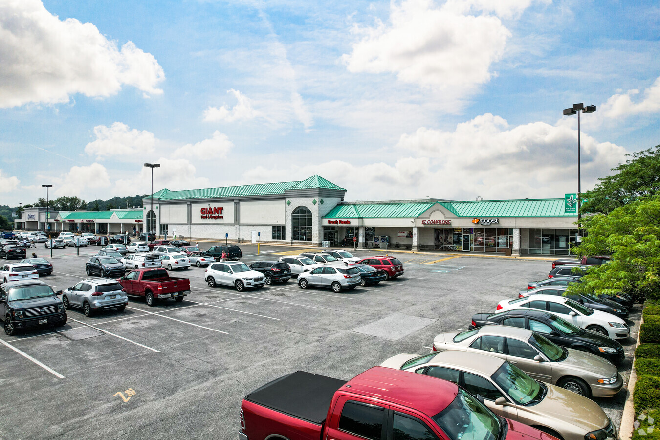
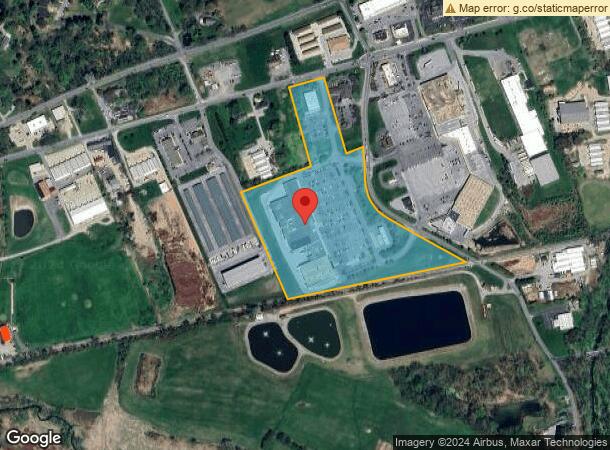
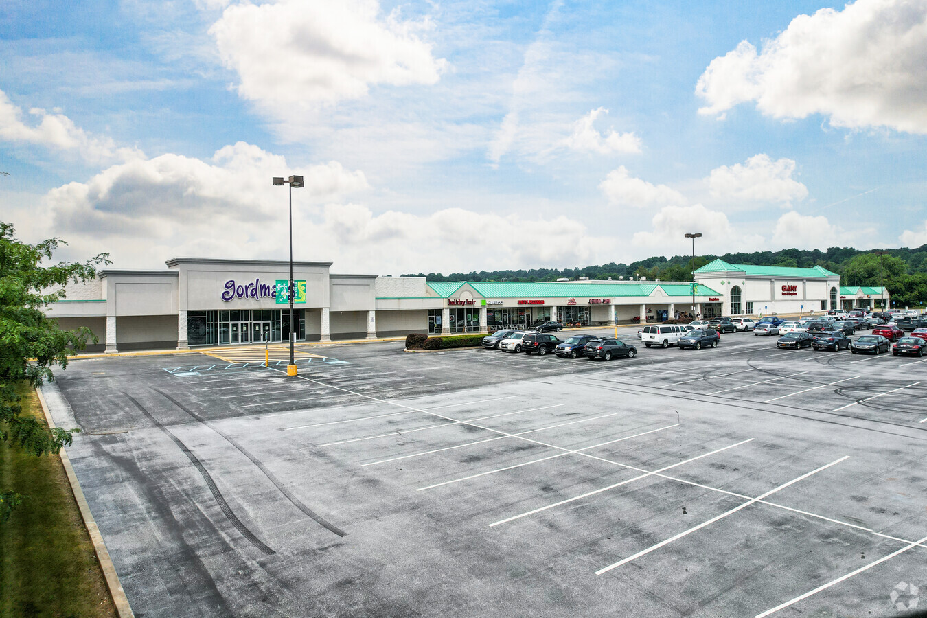
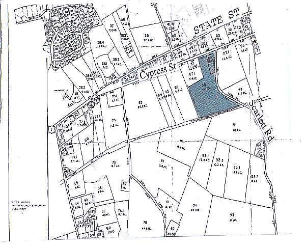
Property Record
350 W Scarlet Rd, Kennett Square, PA 19348
NEARBY LISTINGS FOR SALE OR LEASE
Property Detail
350 W Scarlet Rd
60-002-0088.0000
Alta/Acsm Land Title Surv
Regionalshoppingcenterormallwithanchorstore
18.1 AC & SHOPPING CENTER
X
Chester
42029C0295G
Pennsylvania
2024
18.10 AC
2024
Outer Chester County
306503
Philadelphia
114,126 SF
Philadelphia-Camden-Wilmington, PA-NJ-DE-MD
DEMOGRAPHICS near 350 W Scarlet Rd
1 Mile
3 Mile
5 Mile
2024 Total Population
5,536
23,485
52,915
2029 Population
5,870
24,589
54,878
Pop Growth 2024-2029
+ 6.03%
+ 4.70%
+ 3.71%
Average Age
38
39
42
2024 Total Households
1,857
8,054
18,727
HH Growth 2024-2029
+ 6.19%
+ 4.97%
+ 3.93%
Median Household Inc
$92,315
$109,639
$129,686
Avg Household Size
2.90
2.80
2.70
2024 Avg HH Vehicles
2.00
2.00
2.00
Median Home Value
$385,025
$442,571
$464,346
Median Year Built
1991
1986
1988
Nearby Places
- Restaurants
- Banks
- Shops
- Fitness
- Groceries
PUBLIC TRANSPORTATION
AIRPORT
Philadelphia International
DRIVE
WALK
Distance
Philadelphia International
48 min
28.7 mi
Freight Ports
Port of Wilmington, RI
DRIVE
WALK
Distance
Port of Wilmington, RI
36 min
21.0 mi
SALE & LEASE HISTORY
LISTING DATE
SALE/LEASE

Aug 21, 2019
For Lease
Nearby Properties
Address
Land Use
TOTAL SIZE
Lot Size
Zoning
Address
Land Use
TOTAL SIZE
Lot Size
Zoning
215,130 SF
11.80 AC
R2
Address
Land Use
TOTAL SIZE
Lot Size
Zoning
238,215 SF
35.70 AC
R3
Address
Land Use
TOTAL SIZE
Lot Size
Zoning
105,405 SF
17 AC
R1
Address
Land Use
TOTAL SIZE
Lot Size
Zoning
159,484 SF
22.01 AC
HC
Address
Land Use
TOTAL SIZE
Lot Size
Zoning
121,326 SF
14.98 AC
R2
Address
Land Use
TOTAL SIZE
Lot Size
Zoning
121,326 SF
14.98 AC
R2
Address
Land Use
TOTAL SIZE
Lot Size
Zoning
152,629 SF
152.30 AC
ES1
Address
Land Use
TOTAL SIZE
Lot Size
Zoning
99,228 SF
0.57 AC
C2
Address
Land Use
TOTAL SIZE
Lot Size
Zoning
67,011 SF
6.78 AC
R2A
Address
Land Use
TOTAL SIZE
Lot Size
Zoning
451,182 SF
94.70 AC
BP
Address
Land Use
TOTAL SIZE
Lot Size
Zoning
67,244 SF
9.50 AC
MU
Address
Land Use
TOTAL SIZE
Lot Size
Zoning
69,351 SF
25 AC
UD
Address
Land Use
TOTAL SIZE
Lot Size
Zoning
59,836 SF
6.33 AC
R2
Address
Land Use
TOTAL SIZE
Lot Size
Zoning
74,992 SF
16.26 AC
R2
Address
Land Use
TOTAL SIZE
Lot Size
Zoning
200,337 SF
14 AC
CI
Address
Land Use
TOTAL SIZE
Lot Size
Zoning
64,946 SF
0.18 AC
C1
Address
Land Use
TOTAL SIZE
Lot Size
Zoning
53,134 SF
1.76 AC
R2
Address
Land Use
TOTAL SIZE
Lot Size
Zoning
70,197 SF
64.54 AC
ES1
Address
Land Use
TOTAL SIZE
Lot Size
Zoning
60,936 SF
3.53 AC
R2
Address
Land Use
TOTAL SIZE
Lot Size
Zoning
65,310 SF
5.07 AC
RB
Address
Land Use
TOTAL SIZE
Lot Size
Zoning
87,680 SF
11.40 AC
CI
Address
Land Use
TOTAL SIZE
Lot Size
Zoning
106,200 SF
10.40 AC
CI
Address
Land Use
TOTAL SIZE
Lot Size
Zoning
175,250 SF
50 AC
SA
Address
Land Use
TOTAL SIZE
Lot Size
Zoning
106,210 SF
11.70 AC
UD
Address
Land Use
TOTAL SIZE
Lot Size
Zoning
54,097 SF
3.80 AC
R3
Address
Land Use
TOTAL SIZE
Lot Size
Zoning
46,364 SF
2.15 AC
RB
Address
Land Use
TOTAL SIZE
Lot Size
Zoning
70,448 SF
11.40 AC
CI
Address
Land Use
TOTAL SIZE
Lot Size
Zoning
84,830 SF
10.66 AC
CI
Address
Land Use
TOTAL SIZE
Lot Size
Zoning
128,868 SF
1.25 AC
C2
The World's #1 Commercial Real Estate Marketplace
Connect with us
© 2025 CoStar Group
The information above has been obtained from sources believed reliable. While we do not doubt its accuracy we have not verified it and make no guarantee, warranty or representation about it. It is your responsibility to independently confirm its accuracy and completeness. Any projections, opinions, assumptions, or estimates used are for example only and do not represent the current or future performance of the property. The value of this transaction to you depends on tax and other factors which should be evaluated by your tax, financial, and legal advisors. You and your advisors should conduct a careful, independent investigation of the property to determine to your satisfaction the suitability of the property for your needs.